Taken from the following website: Great Sand Dunes National Park
Basic Geological Story
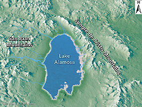
Through the breaking apart and movement (rifting) of large surface plates on Earth's surface, the Sangre de Cristo Mountains were uplifted in the rotation of a large plate. Fossils from the bottom of an ancient sea are now preserved in high layers of rock in the Sangre de Cristos. The San Juan Mountains were created through extended and dramatic volcanic activity. With these two mountain ranges in place, the San Luis Valley was born, covering an area roughly the size of the state of Connecticut.
Sediments from both mountain ranges filled the deep chasm of the valley, along with water from mountain streams and rivers.
NPS ILLUSTRATION
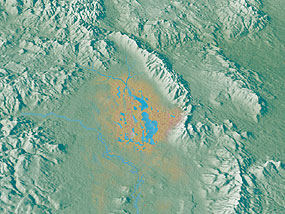
In 2002, geologists discovered lakebed deposits on hills in the southern part of the valley, confirming theories of a huge lake that once covered much of theSan Luis Valley floor. They named this body of water "Lake Alamosa" after the largest town in the valley. Lake Alamosa later receded from climate change, and from its water cutting through volcanic deposits in the southern end of the valley. With the southern end of the valley breached, Lake Alamosa may have drained through the Rio Grande River, forming the Rio Grande Gorge near Taos, New Mexico.
NPS ILLUSTRATION
Smaller lakes still covered the valley floor, including two broad lakes in the northeastern side of the valley. Further climate change significantly reduced these lakes, leaving behind a large sheet of sand geologists call the sand sheet. Remnants of these lakes are still found today, in the form ofsabkha wetlands.

NPS ILLUSTRATION
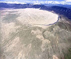
Sand that was left behind after these lakes receded blew with the predominant southwest winds toward a low curve in the Sangre de Cristo Mountains. The wind funnels toward three mountain passes here - Mosca, Medano, and Music Passes - and the sand accumulates in this natural pocket. The winds blow from the valley floor toward the mountains, but during storms the winds blow back toward the valley. These opposing wind directions cause the dunes to grow vertically. See an animation showing how reversing dunes are formed.
NPS/PATRICK MYERS
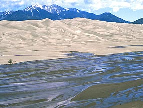
Medano Creek recycles sand each spring along the southern edge of the dunefield.
Two mountain streams, Medano and Sand Creeks, also capture sand from the mountain side of the dunefield and carry it around the dunes and back to the valley floor. The creeks then disappear into the sand sheet, and the sand blows back into the dunefield.Barchan and transverse dunesform near these creeks. Learn more about the hydrology of Great Sand Dunes.
NPS PHOTO
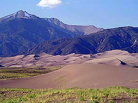
This combination of opposing winds, a huge supply of sand from the valley floor, and the sand recycling action of the creeks, are all part of the reason that these are the tallest dunes in North America. There are other dunes in Colorado, and in most western states in the US, but none as tall (750 feet) and none as dramatic. Here giant dunes rise in front of the alpine Sangre de Cristo Mountains, while streams flow across the sand seasonally, making for an unusual and unexpected sight.
NPS/SCOTT HANSEN
A small dune migrates toward the main dunefield.
Are the dunes still growing? How much do they change over time?
Currently, there is enough vegetation on the valley floor that there is little sand blowing into the main dunefield from the valley. However, even today there are still some small parabolic dunes that originate in the sand sheet and migrate across grasslands, joining the main dunefield. At other times, some of these migrating dunes become covered by grasses and shrubs and stop migrating. Thus, the dunes system is currently fairly stable. When comparing an 1874 photo of the main dunefield with one taken at the same location in 1999, there is very little change in the location or size of the largest dunes. The opposing wind directions balance each other out over time. Also, the main dunefield is moist beneath the thin layer of dry surface sand. In windstorms, the top few inches of sand blows around, and the moist sand remains largely in place.


