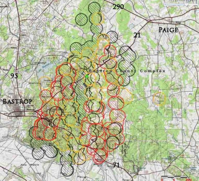
Of course, to those folks in New England who are getting all the rain from the tropical storms, this moisture wouldn't be anything special, but they could use some of this down in Texas where a huge wildfire continues to burn and has destroyed at least 600 homes.

Map of Bastrop fire in Texas, showing heat detected by satellites early in the morning on September 6, 2011. The location is approximate. The most recent heat is shown in red.


