


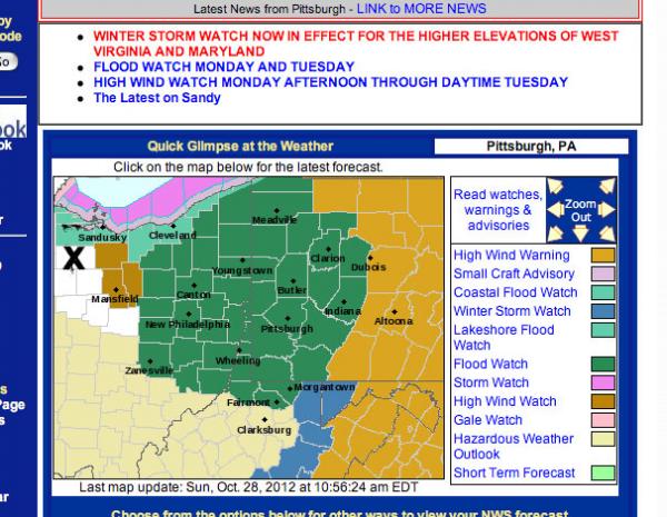
We are already feeling the early effects from Sandy. It hasn't even turned toward land yet, and it is so huge it is driving cold Canadian air down across us. BUT! On the NOAA weather alert maps, we are just outside the severe warning areas. Our county is where I placed the "X."
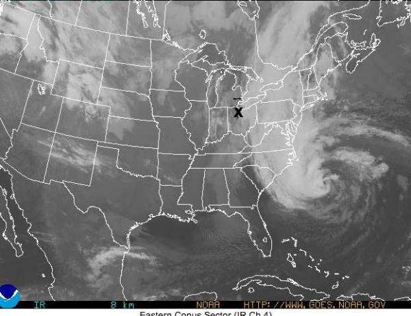
On the NOA satellite photo you can see we are getting the wind rip from the north, all connected to Sandy - still a thousand miles away and offshore. The winds are ferocious today and very cold. We are at the "X."
Snow is predicted, as well as copius rain. We have had a month and a half of rain here. Our cellar got drained, finally, but we watch it almost daily. Some regions are expected to get 24 to 48 hours of constant heavy rain, which could amount to a foot or two in just a couple of days.